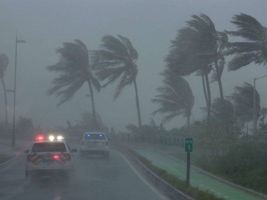

If you live anywhere near the east coast of the United States, you’re probably tracking Hurricane Irma. Especially if you live in Florida or any of the south-eastern United States. To be honest, it looks kind of scary. Hurricane Irma (which I keep hearing as Norma in my head), is one of the most powerful Atlantic storms ever recorded. And in reference to “Norma”, if you knew who I was talking about, you would understand why I keep hearing that name. I joke, but Irma is serious. She is currently on track to wreak havoc on Florida. Having already made landfall on some small islands to the south, she is moving perilously towards the densely populated state with wind speeds of 185 mph.
But no one actually knows where she will go. Which seems kind of weird to me. Weather forecasting is notoriously difficult, even with the technology we have these days, and the best scientific minds working with it. Different approaches to forecasting have led to a mess of different predicted storm paths. And this is actually a big deal. So what should you do if you want to keep a close eye on Hurricane Irma?

Know the Models
There are a few different ways that meteorologists try to predict the path of a storm. Historically, the most accurate model for predicting the track of a storm is produced by the European Center for Medium Range Weather Forecasts, known as the European Model. It uses an array of supercomputers to model weather for the entire planet.
By knowing what the weather will be like all round the world, the theory goes, it’s easier to predict the path of any one particular storm. The downside to the European model is that it only runs twice a day, thanks to the amount of computational power required.
The American equivalent is called the Global Forecasting System (GFS), run by the National Weather Service. It’s run four times per day at a lower resolution, and although it’s not held in as high regard as the ECMWF, the timely data is still useful to forecasters. The National Hurricane Center in Miami uses data from both models, as well as other inputs, when producing its reports. The US also has the Hurricane Weather Research and Forecasting (HWRF), which uses real-time data from aircraft and satellites to monitor changing weather conditions faster than the scientific models. The HWRF was recently key in monitoring the intensity of Hurricane Harvey.

Check the National Hurricane Center
Luckily, you don’t have to weigh the pros and cons of different weather forecasts and monitoring services. The National Hurricane Center produces a number of constantly-updated maps and advisories for tracking a hurricane, and should be your first port of call for information.
It has a central page of information on Irma that provides an overview of the hurricane’s current status, predicted track, and areas that should be taking action. The page also shows the most recent public advisory, forecast advisory, and forecast discussion. The public advisory is a one-page statement that tells you about the likely outcome of the storm, and what action you should take; the forecast advisory and discussion give more information and are more technical.
Be Wary of Other Forecasts
Local weather shows and cable news are liable to show a “spaghetti map” of different types of forecast showing wildly different tracks. Weather forecasters have a good idea of how much they don’t know, and the huge area covered by the NHC’s cone of possibility goes to show it. Just because one archaic model shows your town being passed completely by, doesn’t mean you should ignore the advisories being issued by forecasters for your local area.
All and all, you should keep checking with the National Hurricane Center. They have all the tools and resources needed to help you through the storm. Listen to your local and state authorities. They will have information on evacuating, if you need to. Get yourself prepared in the mean time. Maybe the hurricane won’t come near you, but it doesn’t hurt to prepare yourself if it does. Get an emergency kit. Round up your most precious items that you think you could never part with, so long as they’re small. Pack everything up in the car, if you feel like you need to, and just be ready in case.